

Ganda Marihot Simangunsong
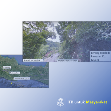
The activity of geotechnical investigations on road slopes around the city of Tasikmalaya are needed as a form of prevention of slopes, mitigation, and readiness to face potentially repeat earthquakes. Settlement in KP. Muara has not fully understood about the potential to the slopes in their area. The purpose of this service is to analyze the stability of dynamic road slopes and slopes that are traversed by railroads due to earthquilkar by guiding in seismological data around the study site. This method uses a direct approach with the holding of geotechnical investigations on slopes, mitigation. As a result of the Tasikmalaya earthquake on December 15, 2017, the slopes of roads in KP. Muara is still safe. However, the slope has the potential to landslides when there is a stretch of earthquake with a larger amplitude than the amplitude recorded at the Tasikmalaya earthquake. If the slopes of the condition of the condition are saturated, the slope also has the potential to be indifferent (the slopes lose their carrying capacity and flows like mud). This can endanger the safety of the population around the settlement in KP. Estuary. This activity will be synergized with the West Java earthquake task force, disaster mitigation center, Bandung Institute of Technology. Keywords: prevention, natural disaster landslides, mapping, slopes of Tasikmalaya.
Disaster emergency handling
There is not any